It is extremely imformative Ditto
Typically, the level of ocean water around the world is higher in the western Pacific and lower in the eastern, near the Western coast of South and North America. This is due primarily to the presence of easterly winds in the Pacific, which drag the surface water westward and raise the thermocline relatively all the way up to the surface in the east and dampen it in the west. During El Nino conditions, however, the easterlies move east, reducing the continuing interaction between wind and sea, allowing the thermocline to become nearly flat and to plunge several feet below the surface of the water, allowing the water to grow warm and expand.
With the help of the National Oceanic and Atmospheric Administration's weather satellites, tracking shifting patterns of sea-surface temperatures can be made easier. Normally, a 'pool' of warm water in the western Pacific waters exists.
![Chart of abnormal ocean surface temperatures [ºC] observed in December 1997 during the last strong El Niño.](/uploads/11/113336/chart-abnormal-ocean-surface-temperatures-c-observed-decembe.gif) Chart of abnormal ocean surface temperatures [ºC]...
Chart of abnormal ocean surface temperatures [ºC]...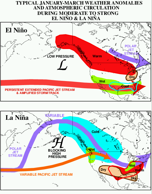 El Niño effects upon North American weather and a...
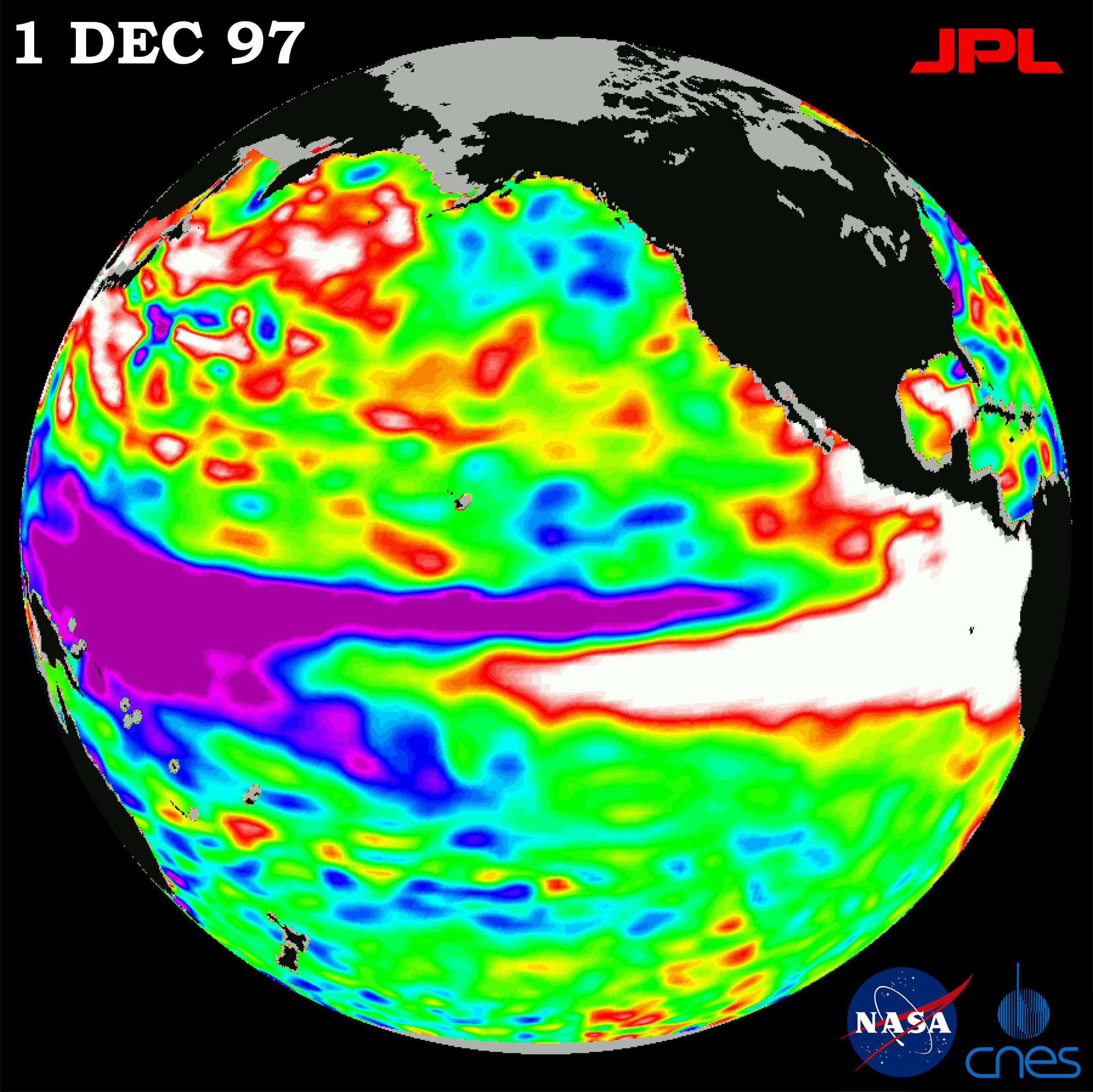 OSTM/Jason-2's predecessor TOPEX/Poseidon caught t...
Under El Nino conditions, this 'pool' drifts southeast towards the coast of South America. This is because, in a normal year, there is upwelling on the western South American coastline, and cold waters of the Pacific rise and push westward. However, during an El Nino year, upwelling is suppressed and as a result, the thermocline is lower than normal. Finally, thermocline rises in the west, making upwelling easier and water colder.
Air pressures at sea level in the South Pacific seesaw back and forth between two distinct patterns. In the high index phase, also called 'Southern Oscillation', pressure is higher near and to the east of Tahiti than farther to the west near Darwin. The east-west pressure difference along the equator causes the surface air to flow westward. When the atmosphere switches into the low index phase, barometers rise in the west and fall in the east, signaling a...