What is Geographic Information Systems (GIS)? According to an ESRI website, a GIS software manufacturer ."..GIS combines layers of information about a place to give you a better understanding of that place." (http://www.gis.com Accessed: 4 June 2004). Put simply GIS is a way to combine and interpret spatial information using technology such as computers.
A website (http://www.geoinnovations.com.au Accessed: 4 June 2004) suggests, most data that is used today has a spatial component or spatial data. Basically this is data with a location. For example it can tell you the land value of certain parcels or land or even things much more complicated like telling you the rapid erosion of sensitive sand dunes. A map is the representation of this spatial information.
The basis of using GIS software is simple however there are many complex parts to it. Basically as was stated before all you are require to do is add and alter the layers needed for your specific task.
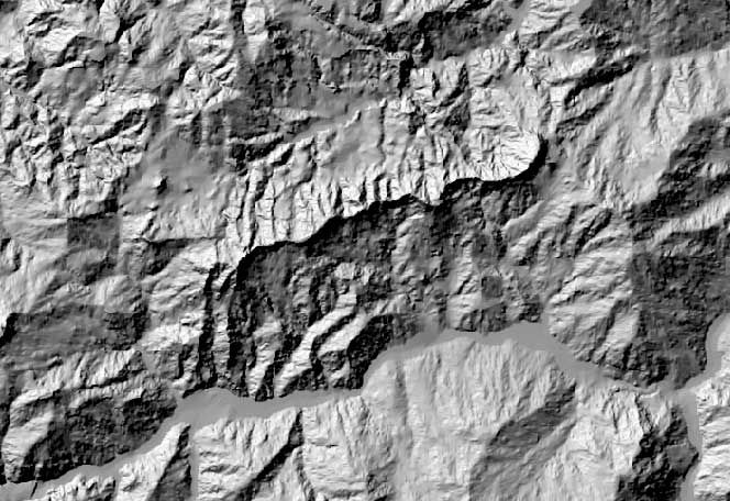 A digital elevation model (DEM) from which a water...
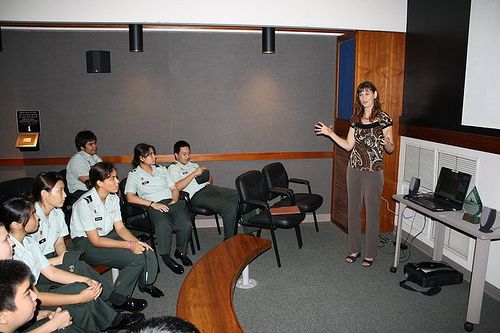 JROTC cadets attend UACE Geographic Information Sy...
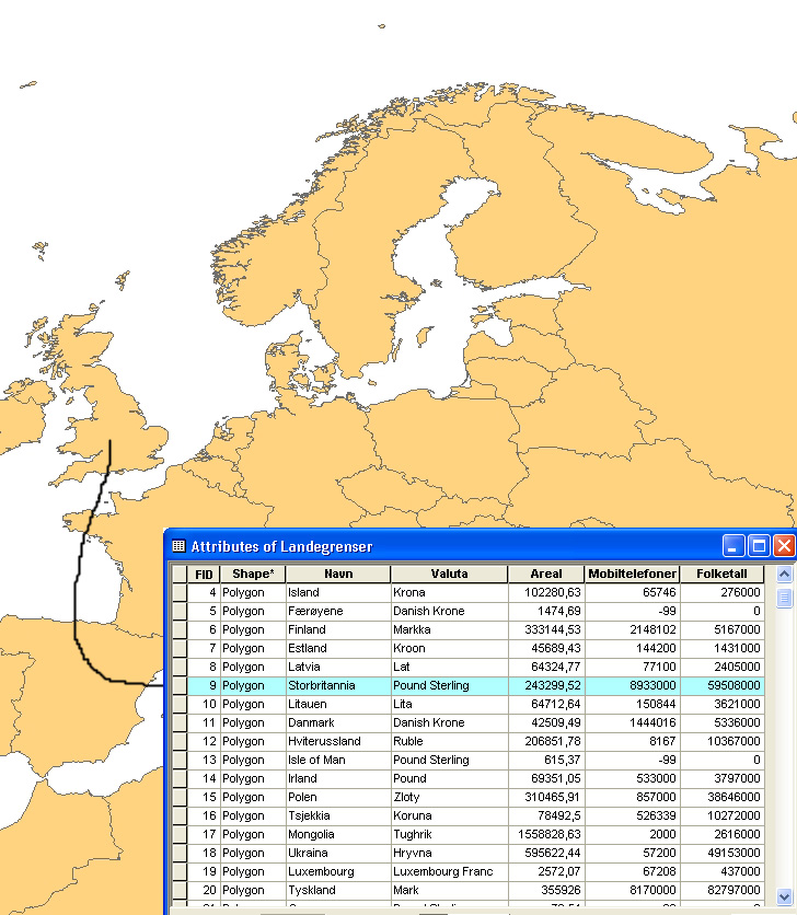 GIS
GISA layer is a group of similar information/data, for example roads and rails could a layer and houses/buildings could be another. To pick out certain data you can run query's through the software. Another feature of the software is that, with permission, you can edit nearly everything simply and also write programs to do tasks for you.
With most Geographic Information systems it is a matter of adding the appropriate data in layers to co-inside with the consumers needs. For example, Fire and emergency services would need maps that show data like available water and access tracks while people interested in environmental damage would need information on the spread of feral species ect.
With spatial data, geographical features are represented mainly using symbology. For example a tree may be a triangle or a certain data may be shaded in colour.