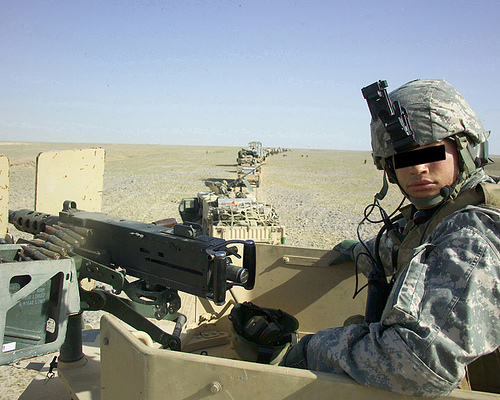
Afghanistan
Afghanistan covers an area of 251,825 sq. mi. The northwestern, western, and southern border areas are primarily desert plains and rocky ranges. The southeast and northeast borders rise higher into the glacier-covered peaks of the Hindu Kush. The northern border is formed by the Amu Darya River and its tributary, the Panj. High mountains cover much of Afghanistan, with about one-half of the land over 6600 ft. in elevation. Small glaciers and year-round snowfields are common. Kabul, in the East, is the largest city and also the capital. Other important cities are Kandahar in the south, Herat in the west, and Maser-e Sharif in the north. Other, smaller towns include Jalalabad in the east, Charikar just north of Kabul, Andkhvoy, Meymaneh, Kondoz, Feyzabad, and Baghlan, in the north. There are dams and hydroelectric stations on the Kondoz, Kabul, Arghandab, and Helmand rivers
The last official census in Afghanistan was in 1979, when the population registered at 15,551,358.
 Afghanistan
 afghanistan
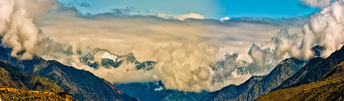 Afghanistan
In 1997 an estimate of 23,738,085, was given, but with war casualties, estimation is difficult. Afghanistan has an annual population growth rate of 4.5%, a birth rate of 4.103%, a death rate of 1.734%, and an average life expectancy of 46.6 years. Afghanistan's infant mortality rate is one of the highest in the world, with 147 deaths for every 1000 live births.
Literacy was estimated to be 32 % for all Afghans aged 15 and older in 1995, 47% for males and 15 percent for females. But, some experts believe these figures are too high, due to war destroying schools.
Most Afghans (about 99%) are Muslims. About 84% Sunnites and about 15% are Shiites. Small groups of Hindus, Sikhs, Parsis, and Jews are scattered in the towns. Mazar-e Sharif, where the tomb of the Muslim leader Ali is said to...