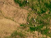
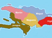
The independent republic of Haiti consists of the western third of the island of Hispaniola, the second largest island in the Caribbean. Haiti shares the island with the Dominican Republic. Covering a total area of 10,714 square miles, Haiti has a northern and southern peninsula separated by the Gulf of Gonave. The shape of Haiti has been compared to a lobster's claw, with the upper pincer pointing toward Cuba and the lower longer claw pointing toward Jamaica. Haiti is bounded on the north by the Atlantic Ocean, on the east by the Dominican Republic, on the south by the Caribbean Sea, and on the west by the Windward Passage.
The Haitian landscape is characterized by broad bands of rugged mountain ranges. The word "Haiti" in the language of the Arawaks, the first inhabitants of the island, means "mountainous land." In all, five mountain ranges cross this country. The longest mountain range, the Massif du Nord, runs southeastward from the Atlantic coast and crosses the border with the Dominican Republic, where it changes its name to the Cordillera Central.
Haiti's highest peak is Pio La Selle, which at 8,793 feet above sea level dominates the Massif de la Selle mountain range. The Chaine du Haut Piton, runs along the northern peninsula reaching a height of 3,881 feet. The Massif de la Hotte reaches a height of 7,770 feet at the extreme western end of the southern peninsula. The other chains which include the Massif des Montagnes Noires and Chaine des Cahos range between 3,701 feet and 5,184 feet high.
Haiti's shoreline is irregular and there are many natural harbors. There are numerous rivers that are short, and basically unnavigable. Only the Artibonite River which is the country's largest is navigable for any length. Saumatre Lake is Haiti's largest saltwater lake...

![English: A border watch tower to control illegal immigration from Haiti located in the Cordillera Central of the Dominican Republic.]]](https://s.writework.com/uploads/9/94759/english-border-watch-tower-control-illegal-immigration-haiti-thumb.jpg)
