The Nile River is the longest river in the world stretching over 4,184 miles (Parsons 2001). It has two sources, one at Lake Victoria, the White Nile, and the second in Ethiopia at Lake Tana, the Blue Nile (Parsons 2001). Although these are its two main sources, many other smaller rivers flow into it as well. The Nile passes through the countries of Burundi, Rwanda, Tanzania, Kenya, Zaire, Ethiopia, Uganda, Sudan and Egypt before emptying into the Mediterranean. Unlike most rivers it runs north rather than south. Southern Egypt, thus being upstream, is called Upper Egypt, and Northern Egypt, located downstream including the Delta is called Lower Egypt (Parsons 2001). The Nile has many distinct areas. Within the southern section, between Aswan and Khartoum, often called Nubia, the river passes through a series of rapids and cataracts which form a natural boundary to the south (Parsons 2001). Through most of Egypt the river has weathered a deep wide canyon into the desert plateau (Parsons 2001).
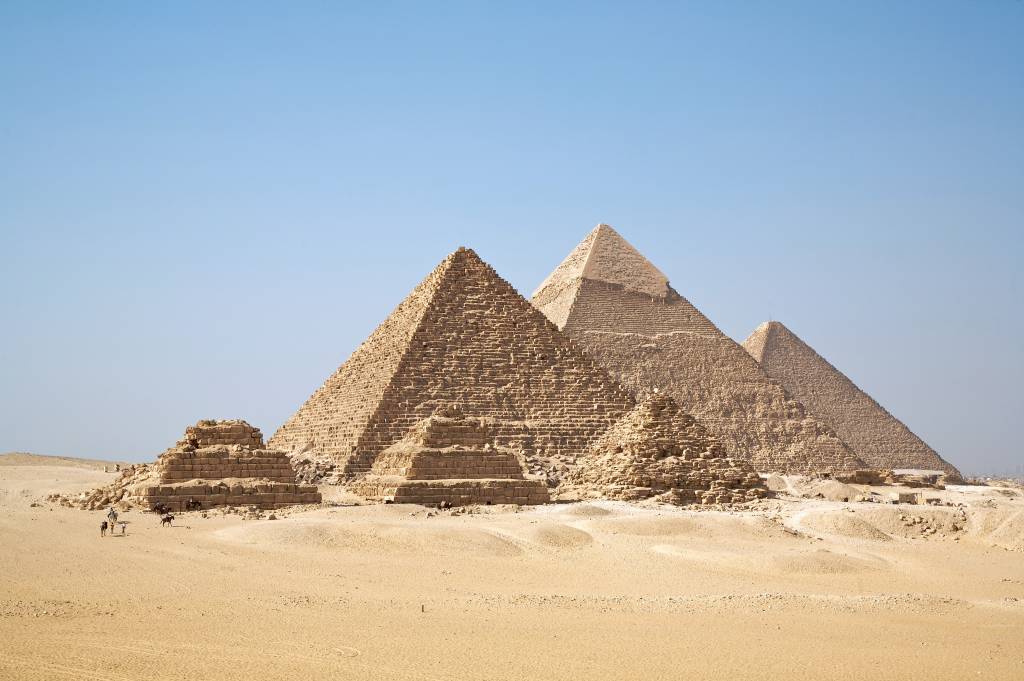 All Giza Pyramids in one shot. Русский: В�...
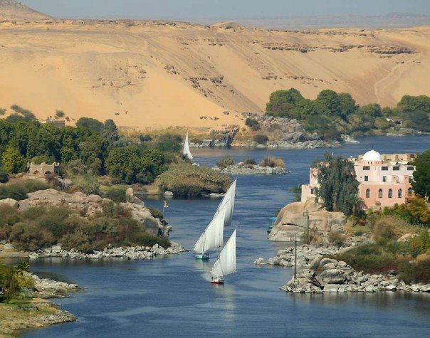 English: The Nile River in Egypt.
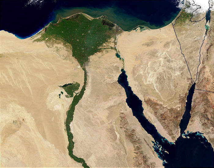 An enlargeable satellite image of the lower Nile R...
The Delta, in Northern Egypt, spans some 8,500 square miles and in its coastal regions holds vast areas of lagoons, wetlands, lakes, and sand dunes (Parsons 2001). The Delta is a region rich in nutrients. Ancient Egyptians called the Nile River Ar, meaning black because of the black sediment it left behind after frequent river floods. They also called it Iteru, which simply meant river (Parsons 2001). The Nile that we know today comes from the Greek work neilos meaning river valley.
During the Paleolithic era the Sahara and the Nile River Valleys were far different than how they appear today. The Sahara consisted not of sand but rolling grass hills with an abundance of vegetation and food. This period lasted until about 30,000 B.C.E. when the climate began to dry and the grass...