Table of Content1.Introduction...................................................................................32.Fieldwork Methods.......................................................................43.Individual Sites Descriptions and Analysis...................................7Location 1.............................................................................7Location 2.............................................................................9Location 3...........................................................................11Location 4...........................................................................13Location 5...........................................................................15Location 6...........................................................................17Location 7...........................................................................19Location 8...........................................................................21Location 9...........................................................................23Location 10.........................................................................254. Overall Descriptions and Analysis.............................................275. Conclusion.................................................................................316. Bibliography...............................................................................327.Appendix.....................................................................................33IntroductionThe aim of my internal assessment is to figure out, by testing my hypothesis, if human infrastructure (influence) affects the bio-diversity and pollutant intake of a rivera, and it's surroundings, ecosystem. In my hypothesis I state that yes, this will in fact affect the bio-diversity and the water will be more polluted in an area very obviously manipulated by humans. To test this, I have taken samples and collected data from ten locations, five in human influenced locations and five in natural, untouched locations.
I choose to rivers, the Brommerbach and the Eisenbach to test. The Brommersbach was full of isolated locations. The Eisenbach on the other hand had many human influenced locations. Below are maps of the two locations.
The Eisenbach river:The Brommersbach river:Fieldwork MethodsThe data collection took place at ten different sites along the two different rivers in the Simmerath, a municipality in the district of Aachen, in North Rhine-Westphalia, Germany.
 Herbst im Taunus
 English: International Day for Biodiversity
 English: A tape measure. Deutsch: Massband
These two rivers were, the Eisenbach and the Brommersbach both rivers were connected to the a main river, The Rur.
The sites where chosen because of there locations near human infrastructure or in isolated locations. At each of the ten sites (figure 2 below) measurements, samples, and data were taken to figure the chemical content, as well as bio-diversity of each location. This Fieldwork Methods section, focuses on the many varieties of methods used, as well as explained details of each method.
numberlocationdescription1.
Eisenbach sourcesource of river, isolated area, forest2.
Eisenbach bridge A3.
Eisenbach bridge Bunder bridge of busy road, influenced4.
Eisenbach parkpark, very influenced, man-mad environment5.
Eisenbach mouthwhere Eisenbach spills into The Eisenbach Sea6.
Brommersbach meets RurJust where Brommersbach and Rur meet, no trees overhead7.
Brommersbach location 2Isolated area, trees overhead8.
Brommersbach location 3isolated, trees overhead9.
Brommersbach location 4isolated, near farms10.
Brommersbach location 5isolated area, fieldFigure 2 ÃÂ showing the ten sites at which measurements were takenAt each location, a number of measurements as well as data collecting was taken. These measurements included: width, depth, water temperature, air temperature, and humidity. As for data collection, data was collected about the species and number of species in the area. Water and dirt samples were collected from every location and were taken back to the lab to test each for pH, nitrite, nitrate, phosphate, nickel, oil, and phosphate. At each site, a planned procedure was used to take down measurements and data The procedure is explained in the following paragraphs of this section, along with the methods used to take the measurements.
First, the channel width (A. on figure 3) was measured. This was done by using a tape measure. The tape measure was held tight from bank to bank, along the water surface. Starting from 0 on the tape, the depth of the water in centimeters was measured.
Once the width was taken, that measurement was taken and divided by ten to get x cm. Every x cm (B. on figure 3) a depth measurement was taken. The depth was measured using a ranging pole. A tape measure was take held across the banks, and the ranging pole was put into the river as deep as it could go, every x cm. Once the ranging pole was in the river as deep as it could go, where the water surface hit the ranging pole was taken note of, this was the depth. From all ten measurements, for each of the ten locations, an average was calculated from the raw data we collected.
Water samples were obtained by letting the water flow into a sample jar and closing the lid, making sure no bubbles get into the sample. The soil samples were obtained by using a soil drill at the river banks of every location. What is done to take the soil sample is push, while turning, the soil drill into the ground. The soil drill is then taken out of the ground and it's contents are put to the side. Pushing the soil drill is then repeated in the same spot. The soil drip is then pulled out again, and these contents are then put into a sample jar. The reason for using the second attempt's contents as opposed to the first attempt's, is so that what is collected is purely dirt. In the first attempt it is possible to obtain other content in the sample (e.i. grass) and this is not what is needed.
Once back in lab the samples are tested for different substances. First the pH-level of a water sample is tested, this is simply done with a pH indicator strip. Then nitrite, nitrate, phosphate, nickel, oil, and phosphate are all tested all using appropriate level indicating test strips. For the soil samples, distilled water is added to the soil and mixed. The same tests that were done to the water, were done with the soil, the test strips were put into each mud sample and the data was recorded.
To compare bio-diversity the quadrate method was used. The quadrate was pre-made out of four strings tied together to form a long rectangle, with each width measuring 30cm and each length measuring 180cm. At each location, the quadrate was set out along the river bank. The amount of different species were noted, as well as their names and an approximation of their occurrence. Identifications were made using an identification sheet, and any unidentified species were collected in jars and taken back to the lab for identifying, using an encyclopedia. Other larger species and high occurrences in species which were not recognized in the quadrate were also taken note of. The goal was to figure out the species richnessá°.
Individual Sites Descriptions and AnalysisLocation 1:Eisenbach, sourceDistance from human influence:10mThe first location tested for data was the source of the Eisenbach River. This location was very close (10m) to human influence. The source of this river started on the edge of small village called Kisternich, where it meet forest area. The biodiveristy was sparse, as everything but a small space around the river had been manipulated by humans.
The chart which follows shows the mineral test results:pHnitritenitratenickelsulfateoilphosphate60mg50mg/l0mg<400mgno0mgThe pH-level of the soil in this location has a pH-level of six, seven being neutral. The pH-level of this measurement is shown to be slightly acidic, it showing a level one less than the neutral level. The is goes hand-in-hand with the abundance of nettles in this location. Nettles are an indicator of acidity.
Nitrate here is 50 mg/l, which is much higher than that of the other locations tested. Nitrate is a naturally occurring chemical form of nitrogen found in most soils. So, it is normal to have a low amount of nitrate in the soil. However, an increased amount, such as this one, can indicate plant residues, animal manures and human wastes decompose.
Acid sulfates in occur naturally in soil. At this location a result of less than 400 mg more than 200 mg was recorded. This is only one indication higher than that of the lowest amount of sulfate from all the samples taken in this experiment. This is a common amount in human influenced areas, however a raised amount could be an indication of algaecide.
Nitrate, nickel, oil, and phosphate were not not detected in these samples.
The chart below lists the plant and animal species found at Location 1, in order from largest abundance to lowest:identified species:plantsanimalsStinging Nettle(Urtica dioica)Ground Beetle ( Coleoptera Carabidae)Broad-leaved Dock(Rumex obtusifolius)snailsButtercup(Ranunculus acris)1 Unidentified species of BeetleCommon Male Fern(Dryopteris expansa)Pond Skater (Gerris remigis)Narrow Buckler Ferm(Dryopteris filix-mas)Dandelion(Taraxacum officinale)total:64The stinging nettle was very abundant through out this location. This goes along with the pH-level of this location being 6, showing some acidity. Stinging nettles typically grow in acidic soil. The leaves and stems are very hairy with non-stinging hairs and also bear many stinging hairs, whose tips come off when touched, transforming the hair into a needle that will inject several chemicals and possibly formic acid into one who touches it.
The broad-leaved dock is a species of perennial weed. These plants are very commonly spotted growing right next to stinging nettles. They have a pH neutralizing effect on nettles because of there low acidity level.
Buttercups and Dandelions are both common weeds that can be found in various location worldwide. There was a high amount of buttercups. A heavy growth of buttercup is an indication of low soil fertility. Buttercups contain an acrid, volatile alkaloid-amenenol, which means they are able to grow in acidic soil. Dandelions are a very common weed because of their abilities to reproduce so easily. They usually grow on soil slightly alkaline (pH- level about 7.5), but they still able to survive in soil slightly acidic for periods of time. At this location Dandelions were sound in sparse amounts, probably due to the fact that the ground was slightly acidic.
Location 2Eisenbach, bridge ADistance from human influence:1.4mThe second location on the Eisenbach, we tested the river right below a bridge off of a main, frequently used, road in Simmerath. This area was very human influenced, not in that the pacific area that was tested had been manipulated by humans, but in that it was directly under a busy road, therefore having direct effects on it's surrounding.
pHnitritenitratenickelsulfateoilphosphate60mg25mg/l0mg<400mgno0mgThe pH-level of the soil in this location has a pH-level of six, seven being neutral. The pH-level of this measurement is shown to be slightly acidic, it showing a level one less than the neutral level. The is goes hand-in-hand with the abundance of nettles in this location. Nettles are an indicator of acidity.
Nitrate here is 20 mg/l, which is the average amount of nitrate found of all locations tested. Nitrate is a naturally occurring chemical form of nitrogen found in most soils. So, it is normal to have a low amount of nitrate in the soil. However, an increased amount, such as this one, can indicate plant residues, animal manures and human wastes decompose.
Acid sulfates in occur naturally in soil. At this location a result of less than 400 mg more than 200 mg was recorded. This is only one indication higher than that of the lowest amount of sulfate from all the samples taken in this experiment. This is a common amount in human influenced areas, however a raised amount could be an indication of algaecide.
Nitrate, nickel, oil, and phosphate were not not detected in these samples.
The chart below lists the plant and animal species found at Location 2, in order from largest abundance to lowest:identified species:plantsanimalsStinging Nettle(Urtica dioica)Ground spiders (Zodarion germanicum)Broad-leaved Dock(Rumex obtusifolius)2 Unidentified species of BeetleGiant Water Lily(Nuphar advena)1 Unidentified species of BeetleDandelion(Taraxacum officinale)Pond Skater (Gerris remigis)Poppy(Papaver rhoeas)1 Unidentified species of TickButtercup(Ranunculus acris)Common Snail(Helix aspersa)1 Unidentified specied of Ferntotal:65The stinging nettle was very abundant throughout this location. This goes along with the pH-level of this location being 6, showing slight acidity. Stinging nettles typically grow in acidic soil. The leaves and stems are very hairy with non-stinging hairs and also bear many stinging hairs, whose tips come off when touched, transforming the hair into a needle that will inject several chemicals and possibly formic acid into one who touches it.
The broad-leaved dock is a species of perennial weed. These plants are very commonly spotted growing right next to stinging nettles. They have a pH neutralizing effect on nettles because of there low acidity level.
Giant water lilies were very common among the banks of the river in this location. These plants were providing a great amount of shade to the river, covering the sides and in some parts of the river, the entire width completely.
Buttercups, poppies, and dandelions are all common wildflowers, there presence often indicate an unkept, untouched location. Dandelions are a very common weed because of their abilities to reproduce so easily. They usually grow on soil slightly alkaline (pH- level about 7.5), but they still able to survive in soil slightly acidic for periods of time. At this location dandelions, poppies, and buttercups were sound in sparse amounts.
Location 3:Eisenbach, bridge BDistance from human influence:3mThe third location tested on the Eisenbach, the river right below a bridge off of a main, frequently used, road in Simmerath. This area was very similar to location 2. The bridges from location 2 and locations 3 were on the same roads, very close apart, and therefore had very similar results. This location was human influenced, not in that the pacific area that was tested had been manipulated by humans, but in that it was directly under a busy road, therefore having direct effects on it's surrounding.
pHnitritenitratenickelsulfateoilphosphate60mg1mg/l0mg<200mgno0mgThe pH-level of the soil in this location has a pH-level of six, seven being neutral. The pH-level of this measurement is shown to be slightly acidic, it showing a level one less than the neutral level. The is goes hand-in-hand with the abundance of nettles in this location. Nettles are an indicator of acidity.
Nitrate here is 50 mg/l, which is much higher than that of the most other locations tested. Nitrate is a naturally occurring chemical form of nitrogen found in most soils. So, it is normal to have a low amount of nitrate in the soil. However, an increased amount, such as this one, can indicate plant residues, animal manures and human wastes decompose.
Acid sulfates in occur naturally in soil. At this location a result of less than 400 mg more than 200 mg was recorded. This is only one indication higher than that of the lowest amount of sulfate from all the samples taken in this experiment. This is a common amount in human influenced areas, however a raised amount could be an indication of algaecide.
Nitrate, nickel, oil, and phosphate were not not detected in these samples.
The chart below lists the plant and animal species found at Location 3, in order from largest abundance to lowest:identified species:plantsanimalsStinging Nettle(Urtica dioica)Pond Skater (Gerris remigis)Broad-leaved Dock(Rumex obtusifolius)Ant (Formica rufibarbis)Buttercup(Ranunculus acris)Mayfly (Ephemeropteridae)Dandelion(Taraxacum officinale)1 Unidentified species of TickMale Fern(Dryopteris expansa)Common Snail(Helix aspersa)Poppy (Papaver rhoeas)1 unidentified species of SpiderGiant Water Lily(Nuphar advena)2 unidentified species of Spidertotal:77This location was very similar to location too. The stinging nettle was very abundant. This goes along with the pH-level of this location being 6, showing slight acidity. The broad-leaved dock is a species of perennial weed. These plants are very commonly spotted growing right next to stinging nettles. They have a pH neutralizing effect on nettles because of there low acidity level.
Buttercups, poppies, and dandelions are all common wildflowers, there presence often indicate an unkept, untouched location. They usually grow on soil slightly alkaline (pH- level about 7.5), but they still able to survive in soil slightly acidic for periods of time. At this location dandelions, poppies, and buttercups were sound in sparse amounts.
Location 4:Eisenbach, parkDistance from human influence:0kmThis location was completely manipulated by humans, it was in a park. This location is of the most human influenced of all the locations in this experiment. While visiting this location there were men cutting the grass. The species found in this location are very different than of that of any other location, because many species here were domesticated and put there by humans.
pHnitritenitratenickelsulfateoilphosphate5.50mg50mg/l0mg<200mgyes0mgThe pH level at this location is the most acidic than any other locations tested. This makes sense because this land was almost completely human manipulated, with even men cutting the grass. This is direct result of pollutant in the water.
Nitrate levels were high, the same as the first location, 50mg/l. Nitrate is a naturally occurring chemical form of nitrogen found in most soils. So, it is normal to have a low amount of nitrate in the soil. However, an increased amount, such as this one, can indicate plant residues, animal manures and human wastes decompose.
Sulfate was low in these samples, no significant amount. This was the only location however, that had oil. This may be the result of the law mowers, or not but it was definatly human induced.
No nitrite, nickel, or phosphate were found in these samples.
The chart below lists the plant and animal species found at Location 4, in order from largest abundance to lowest:dentified species:plantsanimalsGrass ÃÂ human placedCommon Toad /Tadpole (Bufo bufo)Clover (Trifolium repens)Duck (Anas platyrhynchos) -domesticatedDaisies (Leucanthemum vulgare)Flatworm (Dugesia lugubris)Bush (shrub) -human placedGrasshopperDandelion(Taraxacum officinale)Goose (Anser anser domesticus) -domesticatedKoi Fish (nishikigoi)total:56The entirety of the park was covered with grass, even with men cutting it, while making a visit there. This location was interesting because there were shrubs surrounding the river which passed through the park. When standing vertical to the shrubs, a clear distinction is made between the park and unkept surroundings of the river banks.
On the inside of the shrubs, a variety of wildflowers and weeds were identified. Clover, being the most common, dandelions and daisies were all identified in this area. Showing that is had been unkept.
Many tadpoles had been found in this area. Assuming that the only animal we located that could have produced the tadpoles, they are thought to be of toad species. Toads are not domesticated, but they do often occur in residential areas. They have adapted to human infrostucture and therefore a common in areas such as this park.
Ducks and geese were present in the park. These are both domesticated species brought to the park by humans. Koi fish were also present in the river, these being also brought in by humans to the park. With all these domesticated species mixed with the wild species, the park creates an ecosystem so unique to the other locations with biodiveristy in the area that could never occur in nature.
Location 5:Eisenbach mouthDistance from human influence:15kmThis location was were the Eisenbach meets the Rur. The park location and mouth location are relatively close, but the Eisenbach mouth location seemed a little less human influenced, as it was in a town, yet less visited than the park.
pHnitritenitratenickelsulfateoilphosphate6.50mg25mg/l0mg<200mgno0mgThe pH-level at this location is only very slightly acidic. This points out the difference between relatively high acidic soil in very human-manipulated areas compared to the slightly acidic soil in uncommonly human-manipulated areas.
Nitrate levels were at a common amount seen throughout this research, being at 25m/l. No sufficient amount of sulphate was found.
The chart below lists the plant and animal species found at Location 5, in order from largest abundance to lowest:identified species:plantsanimalsStinging Nettle (Urtica dioica)Common Toad /Tadpole (Bufo bufo)Broad-leaved Dock(Rumex obtusifolius)Flatworm (Dugesia lugubris)Buttercup (Ranunculus acris)1 unidentified species of beetleDandelion (Taraxacum officinale)Common Snail (Helix aspersa)Poppy (Papaver rhoeas)Common Toad / Tadpoles(Bufo bufo)Common Male Fern(Dryopteris expansa)Gypsy Moth (Lymantria dispar)Bushes (shrubs) human-placed.
Fire Bugs (Pyrrhocoridae)Water Scorpion (Nepa cinerea)total:78As seen in the five first identified species charts, stinging nettles are the most abundant species in each of the human influenced areas. It goes along with what was mentioned before, that the stinging nettles grow in acidic soils.
Buttercups, poppies, and dandelions are all common wildflowers, there presence often indicate an unkept, unmaintained location.
Ferns are not usually present in human influenced places, unless they are domesticated. These ferns were not domesticated, showing that this location, while it was slightly human influenced, it is also somewhat natural.
Location 6:Brommersbach meets RurDistance from human influence:1.6kmThis location is the point of the Brommersbach where it meet with the Rur. The location was more than 50 meters off of a small road and the closeted infrastructure was a house over a kilometer and a half away. The location was pretty secluded from human info-structure.
pHnitritenitratenickelsulfateoilphosphate60mg50mg/l0mg<400mgno0mgThe pH-level of the soil in this location has a pH-level of six, seven being neutral. The pH-level of this measurement is shown to be slightly acidic, it showing a level one less than the neutral level. It had a trace of nitrate, 10mg/l. A low sulfate amount at less than 200mg.
Nitrate is relatively high at this location at 50mg/l. This is much higher than that of most of the other locations tested. Nitrate is a naturally occurring chemical form of nitrogen found in most soils. So, it is normal to have a low amount of nitrate in the soil. However, an increased amount, such here, can indicate plant residues, animal manures and human wastes decompose. The unusual thing about this location is that it seemed like one of the most secluded locations of all of them, yet it was the nitrate was at a higher level.
No oil was found. Nitrate, nickel, and phosphate were not present.
The chart below lists the plant and animal species found at Location 1, in order from largest abundance to lowest:identified species:plantsanimalsRock Moss (Andreaea rupestris)Earth Worm (Lumbricus terrestris)Giant Water Lily (Nuphar advena)Common Snail (Helix aspersa)Crimson Clover(Trifolium pratense)European garden spider(Araneus diadematus)Common Male Fern(Dryopteris expansa)Pond Skater (Gerris remigis)Rock Moss (Andreaea rupestris)Salamander(Salamandra salamandra)1 unidentified species of mossEuropean garden spider(Araneus diadematus)2 unidentified species of mossSoldier Beetle(Rhagonycha fulva)Dandelion (Taraxacum officinale)Flea Beetle (Altica oleracea)Stinging Nettle (Urtica dioica)total:98The amount of species in this location is much greater than that of any other location mentioned in the locations above.
All the rocks in the area were covers with moss. This presents it's untouched nature. In the human influenced location no mosses what-so-ever were present.
Giant Water Lillies were over the banks of this location, covering the river.
Weeds were present in sparse amounts. A few Dandelions and a one or two nettles were present.
Ferns and clovers are not usually present in human influenced places, unless they are domesticated. These ferns and clovers were not domesticated, showing that this location, while it was slightly human influenced, it is also somewhat natural.
Location 7:Brommersbach location 2Distance from human influence:2.1 kmThis location was an isolated location. The location was not reachable by car. It was in not in a forest, but a field.pHnitritenitratenickelsulfateoilphosphate60mg10mg/l0mg<200mgno0mgThe pH-level of the soil in this location has a pH-level of six, seven being neutral. The pH-level of this measurement is shown to be slightly acidic, it showing a level one less than the neutral level. It had a trace of nitrate, 10mg/l. A low sulfate amount at less than 200mg. No oil was found. Nitrate, nickel, and phosphate were not present. These are all indicators that this location has little (if any) human influence as far as minerals are concerned.
The chart below lists the plant and animal species found at Location 1, in order from largest abundance to lowest:identified species:plantsanimalsGiant Water Lily(Nuphar advena)Ground spiders(Zodarion germanicum)Common Male Fern(Dryopteris expansa)Common Snail (Helix aspersa)1 unidentified species of FernMayfly (Ephemeropteridae)Dandelion (Taraxacum officinale)1 unidentified species of flyPoppy (Papaver rhoeas)Mosquitos (Culicinae)Rock Moss (Andreaea rupestris)Vibrating spider(Pholcus phalangioides)Stinging Nettle (Urtica dioica)Broad-leaved Dock(Rumex obtusifolius)total:75Mayflies actually indicate good water quality. They do not tolerate pollution well, and large numbers are observed only when good water quality is present.
Buttercups, poppies, and dandelions are all common wildflowers, there presence often indicate an unkept, unmaintained location.
Ferns are not usually present in human influenced places, unless they are domesticated. These ferns were not domesticated, showing that this location, while it was slightly human influenced, it is also somewhat natural.
Location 8:Brammersbach, location 3Distance from human influence:3.2kmThis location was far off any beaten path. Themost isolated of all the locations. The location was not reachable by car. At a point we had to get out of the car and hike for about 30 minuets to reach this location. It was in a forest, complete with trees overhead, and giving shade to the entire stream.
pHnitritenitratenickelsulfateoilphosphate61mg/l10mg/l0mg<400mgno0mgThis location was pH neutral. It had a trace of nitrate, 10mg/l. A sulfate amount at less than 400mg. No oil was found. Nitrate, nickel, and phosphate were not present. These are all indicators that this location has little (if any) human influence as far as minerals are concerned.
The chart below lists the plant and animal species found at Location 8, in order from largest abundance to lowest:identified species:plantsanimalsRock Moss (Andreaea rupestris)Mayfly (Ephemeropteridae)Tree MossEarthworm (Lumbricus terrestris)Giant Water Lily (Nuphar advena)Ground spiders(Zodarion germanicum)Dandelion (Taraxacum officinale)Pond Skater (Gerris remigis)Narrow Buckler Ferm(Dryopteris filix-mas)1 unidentified species of TickMale Fern(Dryopteris expansa)Common Cock Shaver(Melonlontha melolontha)1 unidentified species of mossCommon Snail (Helix aspersa)Vibrating spider(Pholcus phalangioides)total:78This location was full of rock moss and tree moss. The entire hill was completely green with spongy moss. This shows it's isolation. Mosses are very sensitive to pollution, and therefore are not present in human influenced areas. This location also had an abundance of mushroom. Fungi and moss are typically found in the same, humid areas. Few weeds were found in this area, mostly lush unique species.
Of the animals in this location, the most abundant were mayflies. Mayflies actually indicate good water quality. They do not tolerate pollution well, and large numbers are observed only when good water quality is present. Earth worms were also in large numbers. They are usually found in humid locations, where the dirt is moist. Pond skaters may, but not necessarily indicate slight pollution.
Location 9:Brammersbach, location 4Distance from human influence:200mThis location was the closest location on this river to human influence. It was about 200 meters from a field were it seemed they kept cows, though there were no cows in the location at the present time.
pHnitritenitratenickelsulfateoilphosphate61mg/l25mg/l0mg>400mgno0mgThe pH-level of the soil in this location has a pH-level of six, seven being neutral. The pH-level of this measurement is shown to be slightly acidic, it showing a level one less than the neutral level. It had a trace of nitrate, 25mg/l. A sulfate amount at less than 400mg. No oil was found. Nitrate, nickel, and phosphate were not present. These are all indicators that this location has little (if any) human influence as far as minerals are concerned.
The chart below lists the plant and animal species found at Location 9, in order from largest abundance to lowest:identified species:plantsanimalsCommon GrassGround Beetle(Coleoptera Carabidae)Buttercup (Ranunculus acris)Snail (Helix aspersa)Giant Water Lily(Nuphar advena)1 unidentified species of spiderDandelion (Taraxacum officinale)Pond Skater (Gerris remigis)Poppy (Papaver rhoeas)1 unidentified species of TickStinging Nettle (Urtica dioica)Broad-leaved Dock(Rumex obtusifolius)total:75Grass was covering this entire location. Many weeds were abundant at this location. Buttercups, poppies, and dandelions are all common wildflowers, there presence often indicate an unkept, untouched location. They usually grow on soil slightly alkaline (pH- level about 7.5), but they still able to survive in soil slightly acidic for periods of time. At this location dandelions, poppies, and buttercups were sound in sparse amounts.
Location 10:Brammersbach, location 5Distance from human influence:1.3kmThis location was very secluded on a hill. It was not a forest area, but a field. The closes indication of human influence was over a kilometer away.
pHnitritenitratenickelsulfateoilphosphate70mg/l25mg/l0mg<200-400mgno0mgThis location was pH neutral. It had a trace of nitrate, 25mg/l. A low sulfate amount between 200mg and 400mg. No oil was found. Nitrate, nickel, and phosphate were not present. These are all indicators that this location has little (if any) human influence as far as minerals are concerned.
The chart below lists the plant and animal species found at Location 10, in order from largest abundance to lowest:identified species:plantsanimalsCommon GrassGround spiders(Zodarion germanicum)1 unidentified species of FernCommon Snail (Helix aspersa)Giant Water Lily (Nuphar advena)Raft Spider (Dolomedes fimbriatus)Dandelion (Taraxacum officinale)1 unidentified species of spiderCrimson Clover(Trifolium pratense)1 unidentified species of tickCommon Male Fern(Dryopteris expansa)Pond Skater (Gerris remigis)Stinging Nettle (Urtica dioica)Mosquitos/larva (Culicinae)Rock Moss (Andreaea rupestris)Dung BeetleBroad-leaved Dock(Rumex obtusifolius)Ground Beetle(Coleoptera Carabidae)Buttercup (Ranunculus acris)Honey Beetotal:1010The most species of any location in the experiment, as well as the closest location on the Brommersbach to human influence.
This location had a lot of grass (cow fields) and many other wild species. Dominated by weeds, this location had dandelions, poppies, stinging nettles, and buttercups. A very obvious suggestion of human influence.
Ground spiders were along the entire ground, under many decaying leaves, it seemed like hundreds of spiders. There were many snails in the area. According to a provided water-quality sheet, a large snails are an indication of moderate-contaminated water. Pond skaters may, but not necessarily be an indicator of moderately pollution. They prey on invertabres that, in large numbers point to pollution, but are also present in smaller amounts in cleaner water.
Overall Descriptions and AnalysisThe pH levels of each locations were very similar. The pH-level barley varied throughout the entire experiment. Most of the locations had a pH level of 6, which is neutral. The locations differences of pH-level is so small, that no further information can be pulled from this data, besides all of the indications on the previous section of this investigation.
The graphs above shows no positive relationship between pH-level / nitrate and distance from human influence. The p-H level and amount of nitrate barley changed at all between the locations, and therefore no further information can be pulled from this data. Also, it was unevenly distributed.
The graph above displays the amount of animals identified at each location. from just looking at the chart, it seems as if the distribution of plant and animal species is at random. However, there is a clear difference between the first five locations and the second five locations of both graphs. The second halves of both graphs do include more locations with higher levels of species then the first half. To make it more clear, I have included both results into the Spearman Rank Correlation, on the next page displays my results.
The scatter graph above does not show a positive increase in plant species occurrence in relationship to distance from human influence. Overall, it looks like a random distribution.
To prove and measure this relationship in statistical terms the SpearmanÃÂs rank correlation coefficient has been calculated.
Spearman Rank Order Correlation - Ungrouped DataStatisticValueCorrelation (not corrected)0.466667Correlation (corrected)0.446859t-Test (n>10)1.412813Degrees of Freedom8Critical 2-sided T-value (5%)2.306000Critical 1-sided T-value (5%)1.860000D-square value (calculated)88.000000D-square value (expected)165.000000Standard Deviation55.000000z-Test-1.400000Observations (locations)10Thus the corrected correlation being 0.446859 (rs = 0.447) and therefore rs < 0.5 means that there actually was no relationship between the distance from human influence and number of plant species in the area. This goes goes against my hypothesis.
Figure 9, above, does show a slight positive relationship between human influence and species of animals. It is not the most clear graph, but below I have included the SpearmanÃÂs rank correlation coefficient to show the relationship statistically.
Spearman Rank Order Correlation - Ungrouped DataStatisticValueCorrelation (not corrected)0.584848Correlation (corrected)0.573434t-Test (n>10)1.979754Degrees of Freedom8Critical 2-sided T-value (5%)2.306000Critical 1-sided T-value (5%)1.860000D-square value (calculated)68.500000D-square value (expected)165.000000Standard Deviation55.000000z-Test-1.754545Observations (locations)10The corrected correlation came out to be 0.573434 (rs = 0.573) and therefore rs > 0.5 means that there actually is a relationship between the distance from human influence and number of animal species in the area. This goes along with my hypothesis.
ConclusionOverall, there were signs pointing to the positive relationship between plant and animal species being less abundant in secluded places, and signs pointing to the opposite. There were many indicators, however pointing to the fact that in-fact the more human influenced places had more pollutant. There are many ways to improve this experiment, however, to get a clearer result.
The relationship between the number of plant species and the distance from human infrastructure came out to not be in relationship to each other, this does not go along with my hypothesis of more species farther from human info-structure. The relationship between the number of animal species and the distance from human infrastructure, however, turned out to be a positive relationship, although not quite a strong one. This does go along with my hypothesis.
As for pollutant, the pH, nitrite, nitrate, phosphate, nickel, oil, and phosphate levels were very similar in every location, only differing slightly. The levels were low, and about the same, therefore not indicating much pollution in any locations. Details are seen on there individual analysis.
Overall, my results do back up my hypothesis, not very strongly, but do show a somewhat of a relationship between human influence and number of species/pollutant.
A stronger relationship may have been present, if more data had been collected and more equipment was available. A device to count the microscopic animal species would have made the results more efficient. Also, time permitted it would have the population of the species could have been more accurately calculated and the Shannon-Wiener IndexâÂÂ¥ could have been used to calculated the biodiveristy.
BibliographySoftware:Wessa, P. (2007), Free Statistics Software, Office for Research Development and Education,version 1.1.21, URL http://www.wessa.net/http://en.wikipedia.org/wiki/Species_richnesshttp://en.wikipedia.org/wiki/Stinging_nettlehttp://en.wikipedia.org/wiki/Zodarion_germanicumhttp://extension.missouri.edu/publications/DisplayPub.aspx?P=G9808http://en.wikipedia.org/wiki/Acid_sulfate_soilhttp://greennature.com/article2600.htmlAppdendix
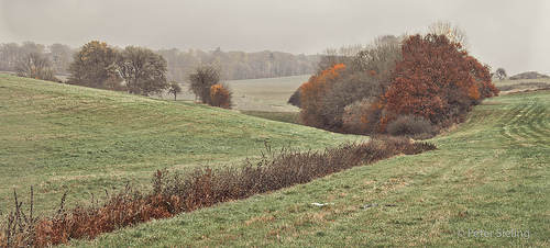
 English: Watlington. Looking southwest from the B4...
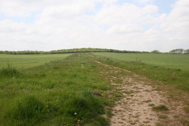
 Baner Hill, the site of the proposed bio-diversity...
 English: im growing the lily and would highly reco...