Air masses are how weather travels through out the world and the
weather creates weather patterns.Air masses and accompanying fronts do not
remain stationary for long. Although their movements are never exactly the
same, they do exhibit some patterns that help meteorologists and others predict
the weather. The boundary between two air masses is called a front. As a result,
moving fronts indicate a change in the weather. The fronts are moved in things
called Jet Streams On a weather map fronts are drawn where there is a large
change in temperature and a shift in wind direction. A front can also be
described as the boundary between adjacent Highs with different conditions.
Meteorologists often call climate patterns "oscillations," since they
change on time scales ranging from days to decades. Interactions between the
atmosphere and the oceans are at the core of most of the patterns. The
atmosphere and ocean push and pull against one another.
 Jet streams flow from west to east in the upper po...
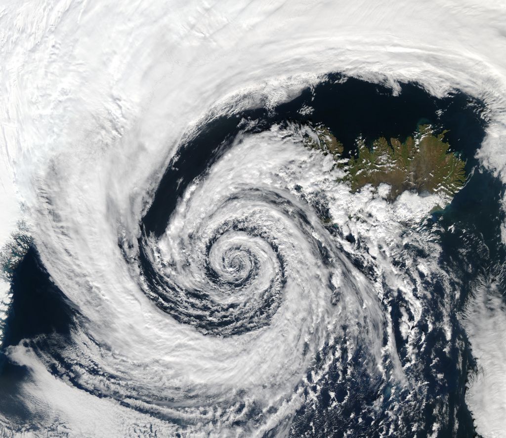 A large extratropical low-pressure system swirls o...
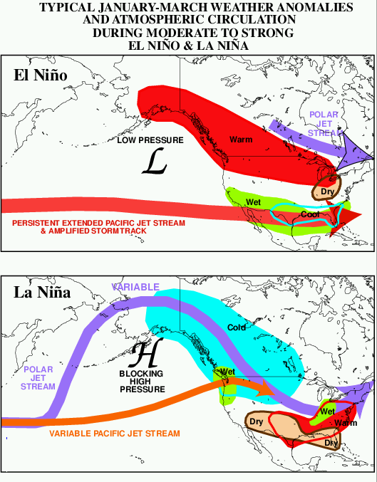 El Niño effects upon North American weather and a...
When one does
something, it affects the other. Since the ocean is much slower to respond to
environmental changes than the atmosphere, the two players are unequal
partners.
Jet streams are bands of very strong winds which occur at limited
altitudes usually in the 30-40000 feet area. They can be over 150 miles wide and
1000 miles long and can travel at over 250 mph. Like most winds they occur
where there is a difference between hot and cold, and in the jet stream's case
this means around the joins of tropical and polar air The jet stream is a river of
fast flowing air at high altitudes above the earth that generally flows from west to
east over the mid-latitudes.To be called a "jet stream" the winds should be faster
than 57 mph. Usually, the jet stream separates cold polar air...