Geography
Geography and climate have always had very potent effects on culture. Geography, or the study of relationships between people and locations on Earth, very often shapes the way people live and interact with each other. Climate, or the prevailing weather patterns over time of a region, also has drastic effects on society and cultures, and these statements are especially true in the South East Asian nation of the Philippines.
The Republic of the Philippines is an archipelago, or chain of islands, located off the south-eastern coast of Asia. Consisting of over 7,000 volcanic islands with a total land area of nearly 300,000 square kilometers (approximately the size of Arizona), islands of the Philippines are predominantly mountainous except for densely populated coastal plains on larger islands. The country is located over the Philippine Trench, a plate tectonic boundary which forms part of the Ring of Fire (see Map #2). The Ring of Fire, a region closely associated with volcanic and earthquake activity, lends a heavy influence to volcanic activity on the islands of the Philippines (one such example is Mount Pinatubo, a very active volcano on the island of Luzon.
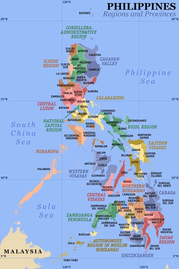 Provinces and regions of the Philippines
 The Luções were a people from the island of Luzo...
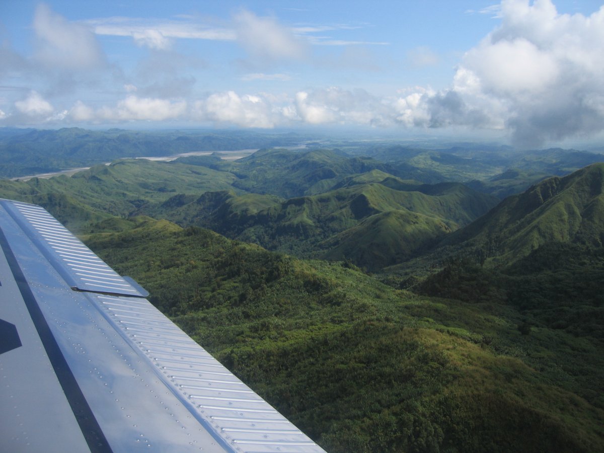 Green mountainside Mount Pinatubo, Luzon, Philippi...
See Map #1 for location of Luzon). The geography allows for some cultural diffusion, Islam, Buddhism, and Christianity all reached the islands by the mid 117th century although there are still places that are extremely isolated to the point of having no electricity7 at all and primitive methods of life.
The climate of the Republic of the Philippines is a warm and moist one. Affected by a northeast monsoon from November to April and a southwest monsoon from May to October, warm winds and moderate rainfall dominate the climate patterns of the nation. Approximately nineteen percent of Filipino land is arable, the second most in the region of South East...
Very nice
I gained a new perspective on the Philippines! where are your sources though?
0 out of 0 people found this comment useful.