Eucalypt leaves are covered with oil glands. The copious oils produced are an important feature of the genus they help defend it from herbivores because in large amounts they are toxic. It is thought the trees shed very large branches to conserve water during periods of drought.
Eucalypts are well adapted for periodic fires, in fact most species are dependent on them for spread and regeneration. They do this via lignotubers, epicormic buds under the bark and from fire-germinated seeds sprouting in the ashes.
eucalyptus trees are so well adapted to fire that a conflagration actually causes them to flourish. Soon after a fire dies out, chemical changes triggered by the flames' heat cause epicormic buds under the bark which are fire-germinated so they sprout in the ashes. seeds are spread by fires hot winds that creates new tree colonies far and wide.
MORETON BAY FIG (FICUS MACROPHYLLA)It is a rainforest plant and in this environment more often grows in the form of an epiphytic strangler vine than that of a tree.
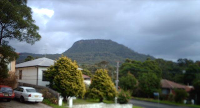 Mount Keira seen from Wollongong suburb of Keiravi...
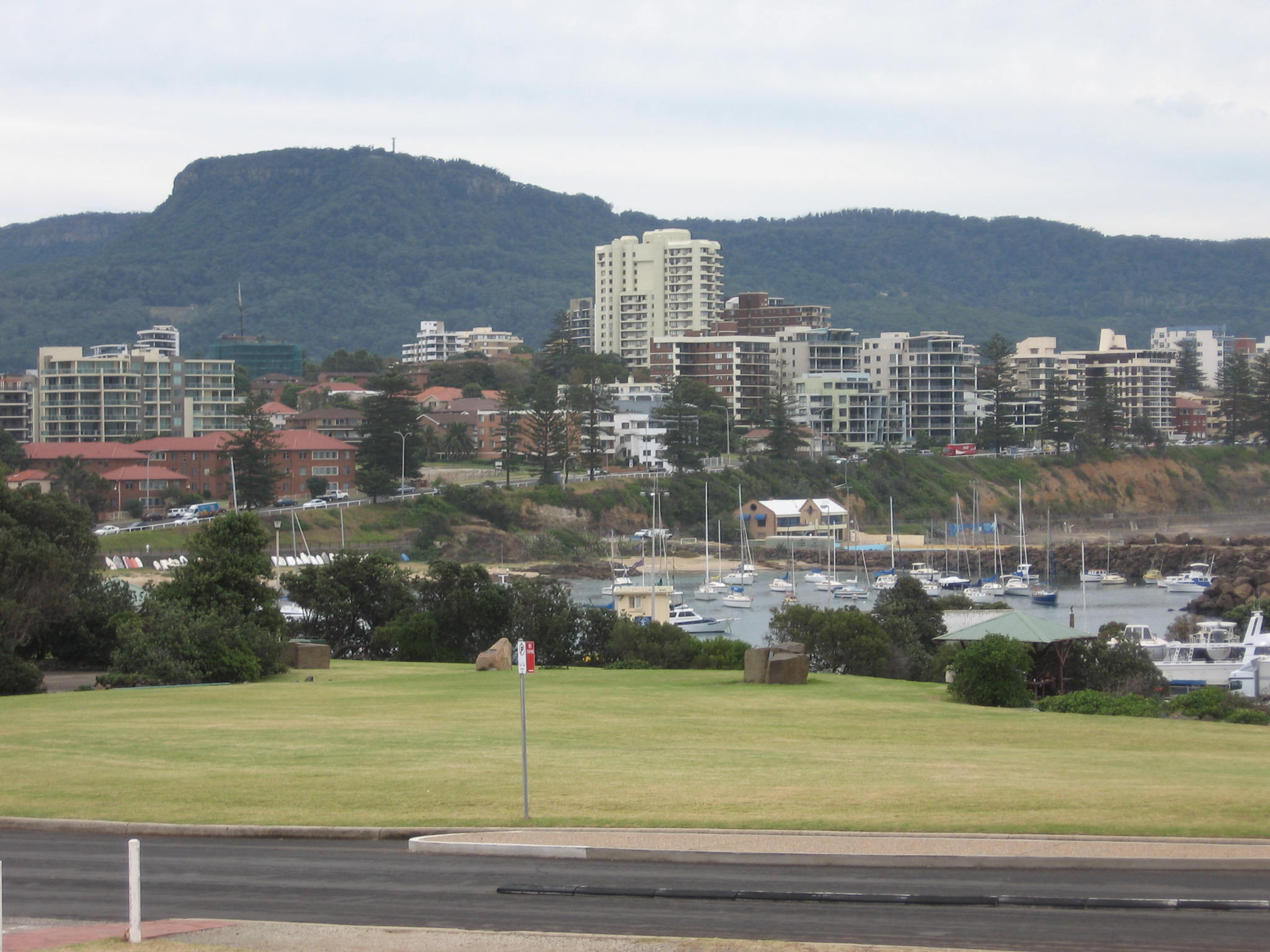 English:
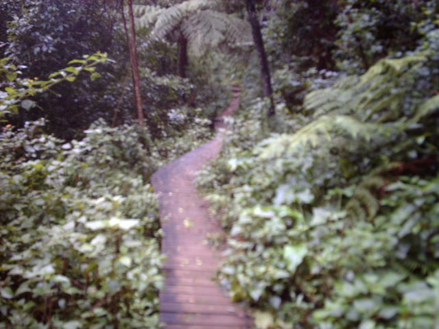 Mount Keira Ring Track
When its seeds land in the branch of a host tree it sends aerial, 'strangler' roots down the host trunk, eventually killing the host and standing alone. This reduces its competition for nutrients and water that is available in the soil.
Its roots are surface feeding and it is therefore quite susceptible to the compacting of earth around its trunk, which makes it difficult for other species to germinate. It is water hungry so it will starve other plants of water and nutrients.Characteristically it has extensive aerial roots that descend into to the ground, providing extra support and nourishment. This allows the fig to slowly spread outwards. The largest specimen recorded covered an entire hectare. This allows it to have a greater area to extract and gain nutrients from the ground.
RAINFOREST LEECH (CHTONOBDELLA LIMBATA)They all have an anterior (oral) sucker formed from the first six segments of their body, which is used to connect to a host for feeding, and can also release an anesthetic to prevent the host from noticing the leech. They can stay attached by using a combination of mucus and suction (caused by concentric muscles in those six segments) the leech saliva contains a peptide called hirudin, which is a highly effective anticoagulant. The leech needs this to prevent blood clots (which would block its feeding) from forming in the wound created by its mouthparts. The vasodilator causes the blood vessels near the leech to become dilated, and thus provide the leech with a better supply. Leeches are hermaphrodites, they are organisms that have both female and male reproductive organs. They also use clitellums to hold the eggsLEWINS HONEY EATER (MELIPHAGA LEWINI)Have a highly developed brush-tipped tongue frayed and fringed with bristles which soak up liquids readily. The bill is curved which largely reflects the type of flowers they are visiting. The tongue is flicked rapidly and repeatedly into a flower, the upper mandible then compressing any liquid out when the bill is closed.
It mainly feeds on insects but supplement their diets with a considerable amount of nectar and fruit.
.
Tree typei) Total amount counted in class[total from all 11 groups]ii) Population in 100 square metres[ i) ÷ amount of quadrants(11)]iii) Population in 1 hectare[ ii) x 9.8 x 100]a) Moreton Bay Fig77 ÷ 11 = 0.640.64 x 9.4 x 100 = 601.6b) Brown Beech2626 ÷ 11 = 2.362.36 x 9.4 x 100 = 2218.4c) Cabbage Tree Palm2424 ÷ 11 = 2.182.18 x 9.4 x 100 = 2049.2d) Sassafrat1717 ÷ 11 = 1.551.55 x 9.4 x 100 = 1457The abundance of the following trees are estimations from the entire classes group data from their quadrants that were 10m by 10m.
The population of the following trees on the Mt Keira Summit Park which has an area of 9.4 hectares:ABUNDANCE TABLEHUMAN IMPACTSHuman impacts, in the form of logging, agriculture, urbanization, industrialization, and tourism , have reduced such rainforests throughout Australia, which threatens both the plants and the animals of the region.
Early settlers cleared a lot of the forest by logging as red cedar at the time was very valuable and was like gold in the timber industry. Early logging removed most of the oldest and largest tall forest trees in the area but there is a stand of Turpentines as tall as sixty metres and over two metres in diameter near Mount Keira. This clearing of trees created a lot of open land which could be used for farming.
In 1828 James Spearing was credited with the 400 acres cleared and 250 acres cultivated, 5 horses and 50 horned cattle. He also had a flock of 750 sheep which was the only flock in the district. He became the principal agriculturalist of the district in the early 1830s. Soils were relatively infertile unlike the forest ecosystem which had previously existed had kept the soil fertile by providing nutrients by decomposition. The 'Paulsgrove Diary' clearly illustrates the early agricultural industry at Mount Keira. The diary shows the acreage to have been, in 1833 and 1834, about 40 acres. The hillside at Mount Keira had fields of wheat, maize, barley, oats, rye, rape, turnips, onions, potatoes, peas and tobacco. There was also a well kept orchard containing peach, apricot, nectarine, plum and pear trees, as well as grape vines. There was also a large pig run. There were two watermills on Para Creek, running through the property. These were later replaced by a windmill.
Mining for coal in the region started, James Shoobert was a pioneer in coal mining at Mount Keira. On the 27th August 1849 the first load of coal was transported down from Mount Keira to Wollongong in horse drawn coal carts. A coal boom in the late eighties saw men brought in from European countries, and houses were built closely adjacent to the mine so that these people could be housed. This brought a great deal of residential building which interfered and reduced the habitats of native wildlife. Along with this residential development came the issue of domestic animals which unbalance the natural order of the ecosystem creating more competition for native animalÃÂs resources, they also pose a threat of being predators to the native species.
In April 1834 the Governor, Major-General Sir Richard Bourke, visited the Illawarra in reply to a petition presented to him by a number of inhabitants asking for roads and safe harbours in the district. The Mount Keira Road and other coastal roads were laid out in 1835-1836 by convict labour. This required a lot of interference with the ecosystem, and put local wildlife at risk of being hit by motor vehicles or affecting their habitat.
In recent times Mount Keira is used intensively for tourism and recreational purposes such as bushwalking, picnicking, sight-seeing, rock climbing and school trips. Local authorities have tried to help conservation and protection of the Mt Keira ecosystem with things like placing in walking tracks, creating laws against the cutting down of trees with significant value and promoting the high importance and value of the ecosystem to the local community through education with things such as such as school group trips and scout clubs.
BibliographyMount Keira Scout Camp: 50th Anniversary Booklet. Scout Camp, 1990Spires, Robert. History of Kemira Colliery. 1857 - 1984. Wollongong. 1990.
Wollongong City Council, viewed June 3, 2007, http://www.wollongong.nsw.gov.au/library/localinfo/mtkeira/#environmentlast modified 15:52, 30 April 2007. Wikipediaî is a registered trademark of the Wikimedia Foundation, Inc., a US-registered 501(c)(3) tax-deductible nonprofit charity. Viewed 3 June, 2007, http://en.wikipedia.org/wiki/Mount_Keira.
Copyright Department of Environment & Conservation (NSW) -Information on this park last amended on 25 April 2006. viewed 3 June, 2007, http://www.nationalparks.nsw.gov.au/parks.nsf/ParkContentByDistance/N0620?OpenDocument&ParkKey=N0620&Type=ICopyright é 2007 Answers Corporation. All rights reserved, viewed 3 June, 2007, http://www.answers.com/topic/mount-keira
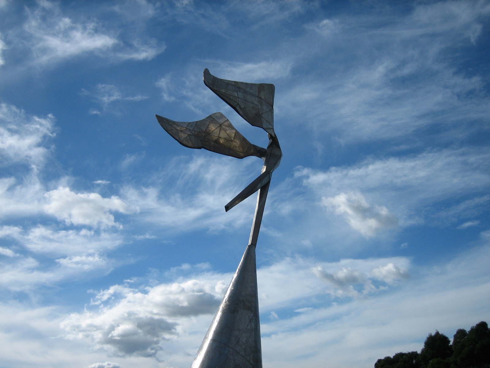 Lawrence Hargrave Sculpture (detail) by Bert Fluge...
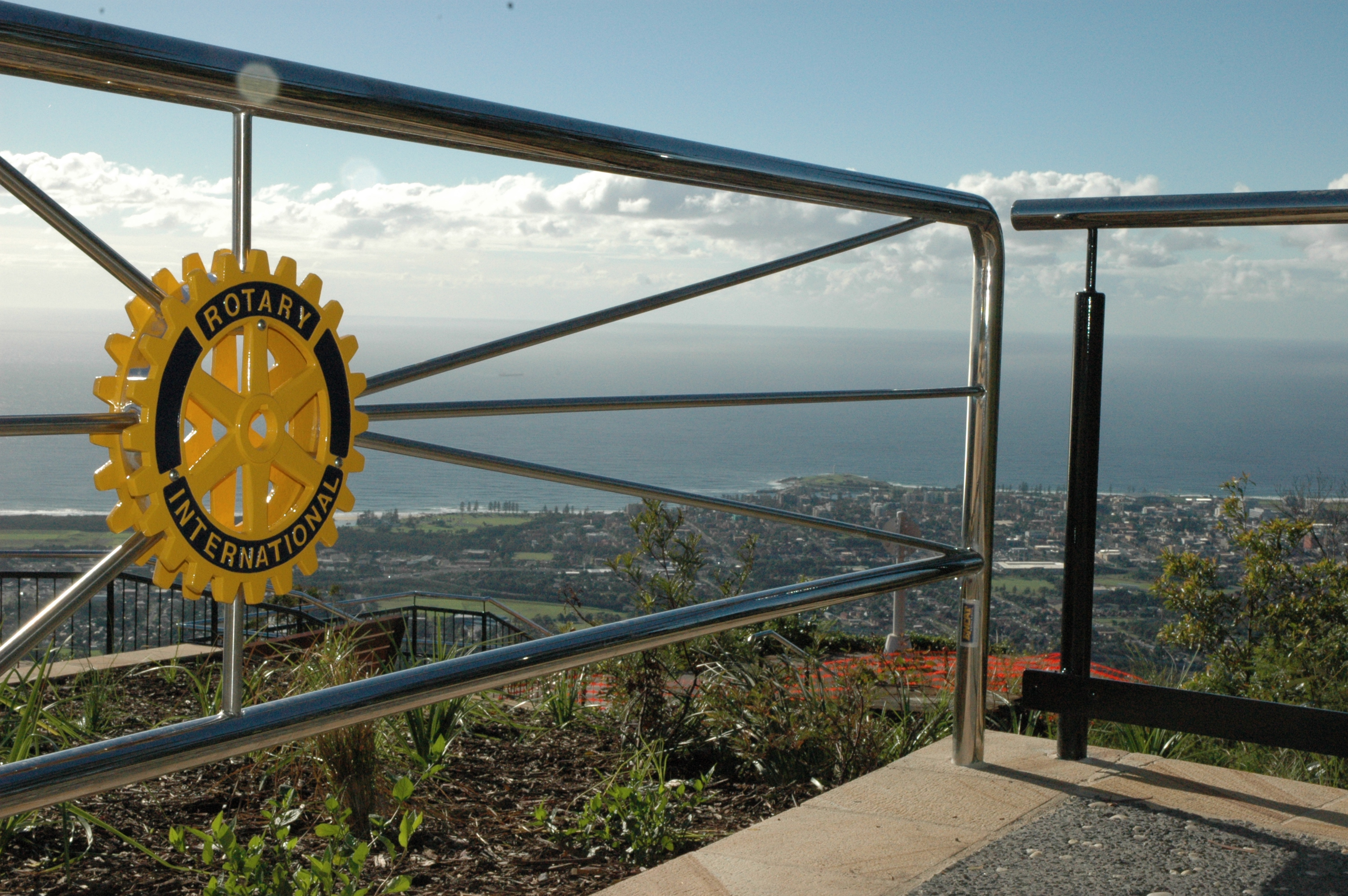 Mount Keira Summit Park, a project of the Rotary C...
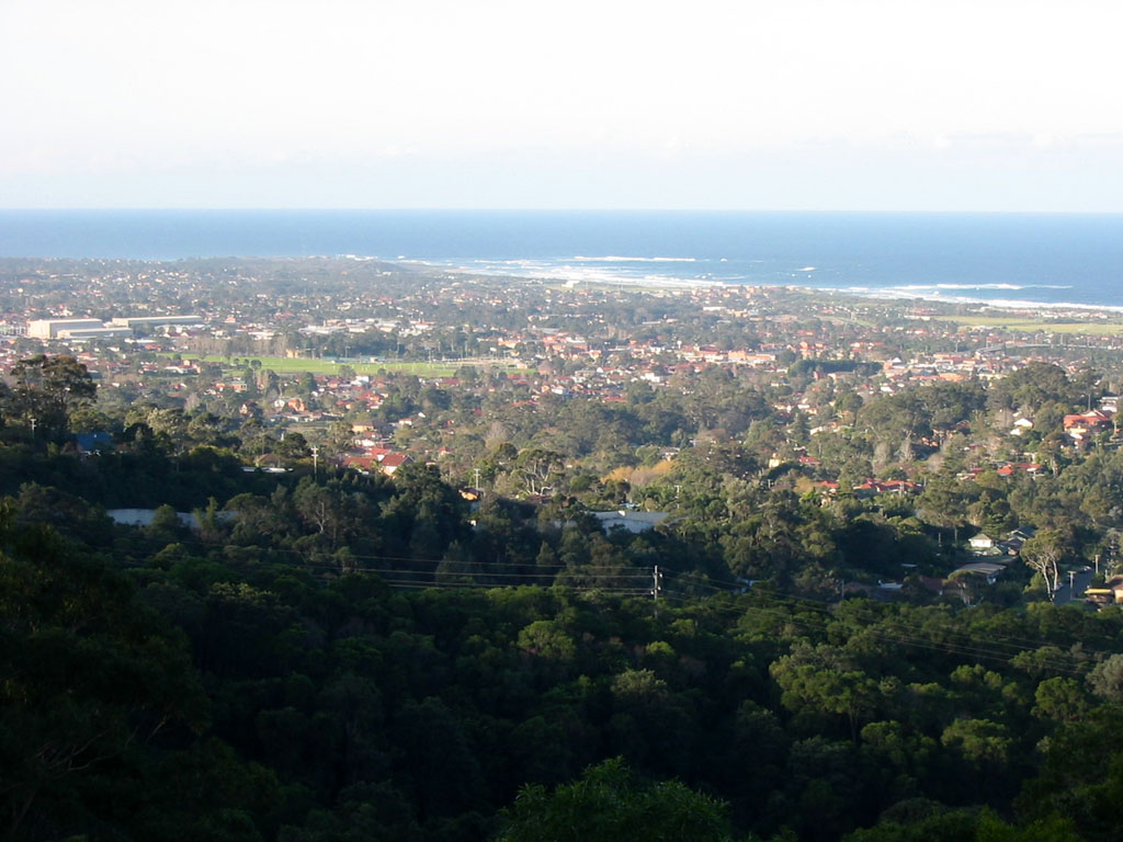 From mount keira