HISTORY 2 GEOGRAPHY 4 LOCATION 4 CLIMATE 4 TOPOGRAPHY 4 NATURAL RESOURCES 5 LAND USE 5 THE MAP 6 TOPOGRAPHY MAP 6 POLITICAL AND PHYSICAL MAP 7 THE GREAT ORINOCO RIVER 9 QUICK FACTS 10 WORK CITED 11 HISTORY Venezuela is the most northerly South American nation with the Caribbean Sea directly to the north. Christopher Columbus encountered Venezuela, the homeland of the Carib and Arawak Indians, on his third voyage to the New World in 1498. The area was named Little Venice by the European explorers in 1499 when they saw how the Indians built their villages on pilings over Lake Maracaibo. In the 1500's Spain sent many expeditions to explore the possibilities of settlement and future development, which led to the founding of the city of Caracus by Diego de Losada in 1567. This spread to the colonization of Venezuela throughout the 17th century. Venezuela's economy grew quickly in the 18th century and Caracus became its focal point, providing administration to the provinces of Venezuela, and its judicial, military and educational institutions.
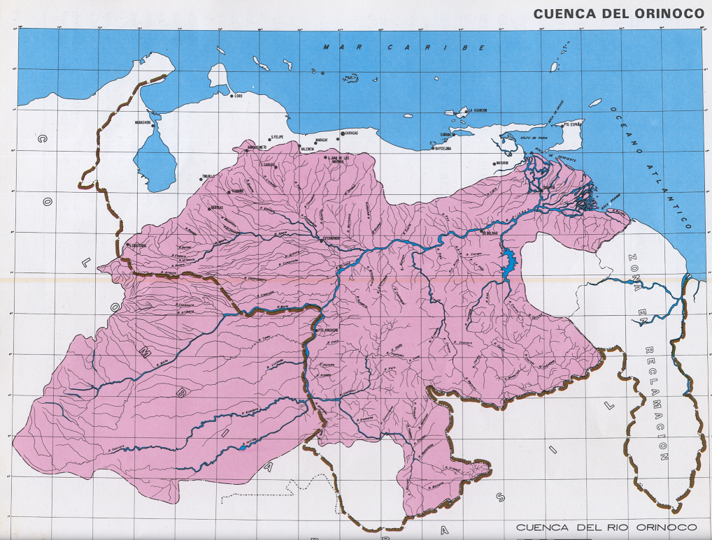 The Orinoco watershed, the Orinoquia - an area of ...
 Map of the Cassiquiare canal based on Alexander vo...
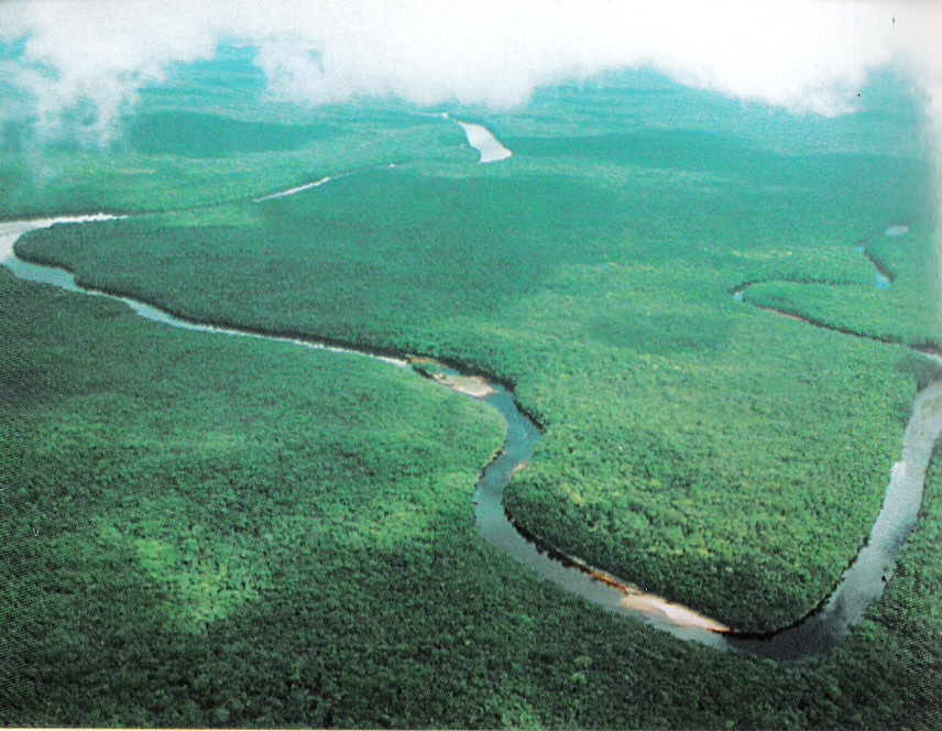 Panorama of the Orinoco River.
With the influences of other continents came the decline of the Spanish Colonial Period by 1810. Venezuela was part of the formation of Gran Columbia, which included Columbia and Ecuador, from 1820 until 1830 when the confederation broke apart and Venezuela became an independent nation. The 19th century was flooded with dictators, civil wars and poverty. But, by the 1890's attention returned with interests in U.S. asphalt companies, Guyana gold, the Isthmian Canal project, and control of the Orinoco River mouth. The early 1900's came with German and British blockades on the coast, and relations with the United States being broken by 1908. Throughout the 1920's and 1930's focus was put on establishing good relations with foreign powers and opening its arms to multinational oil companies.